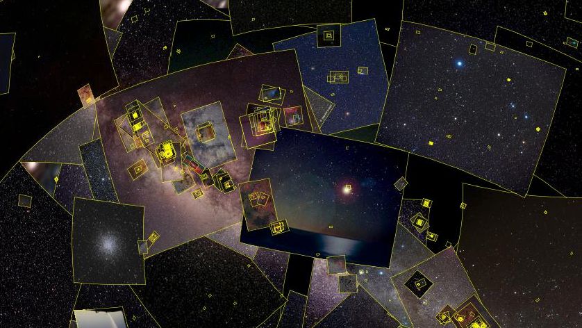
Sky-Map (Wiki Sky) is an amazing reference site.
It integrates thousands of images of all resolutions on the same principle as Google Maps, i.e. from any point in the sky or any spatial coordinate, you can zoom in and zoom out until you see the smallest points of light with the same acuity as the largest telescopes.
Better still, hover your mouse over any of these points to obtain the star's complete pedigree: dimensions, luminosity, name, coordinates, distance, etc. and, if you click on it, obtain high-resolution photos via direct access to the database.
You can, of course, change the resolution, superimpose photos on graphic interpretations, navigate by coordinates, obtain the view directly above you in real time, add a grid, display constellations, etc., and so much more to discover, such is the depth of the site.
Don't be put off by the sober, motionless appearance; if you do nothing, nothing happens, but if you start poking around, especially if you activate the first icon on the left (Sloan digital sky survey) you'll get visual acuity in all radiation bands. The invisible will reveal itself to you.
If you enlarge the scene, you'll virtually travel through one of the best representations of space on the Internet.
The site is complemented by various references and communication tools.
In short, Wiki Sky opens up the universe to the notion of space.
Sky-Map - Wiki Sky